Above normal accumulation rates in Eastern Greenland

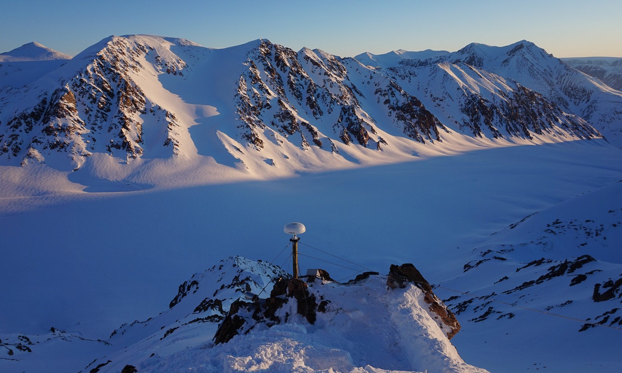
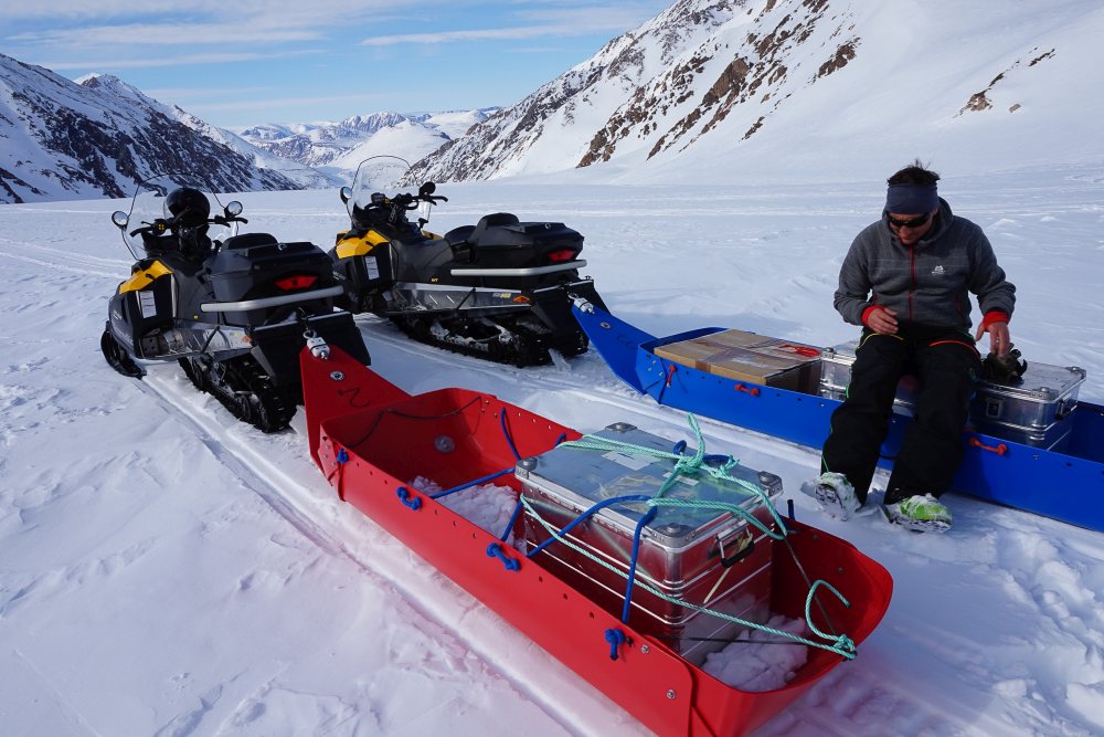
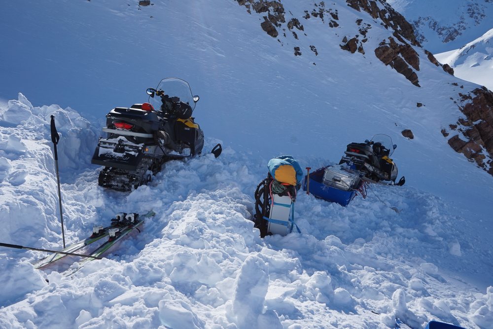
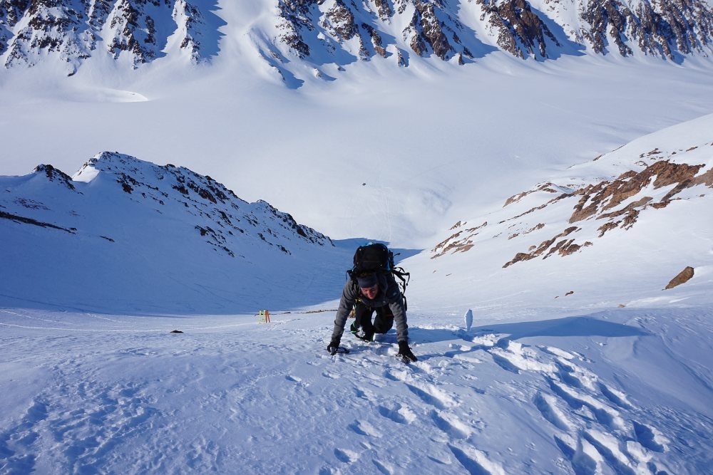
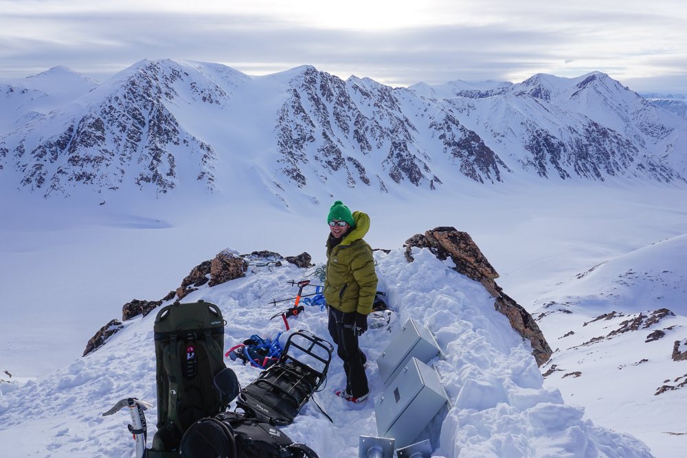
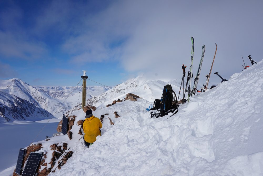
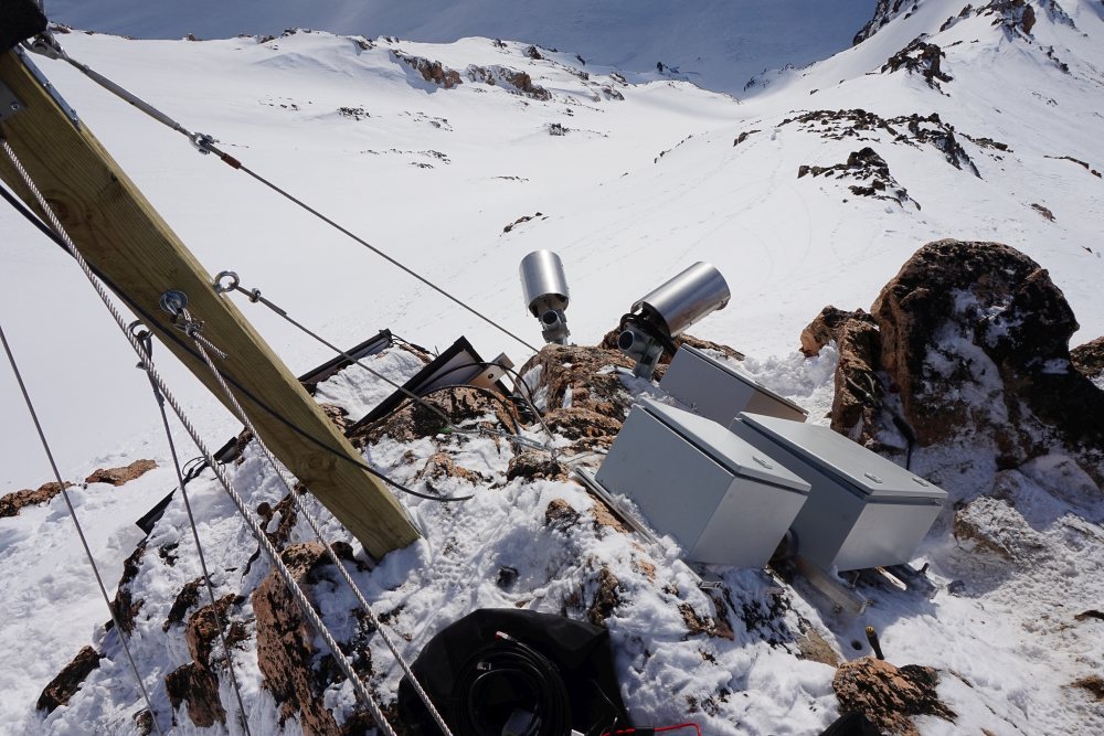
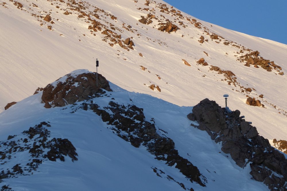
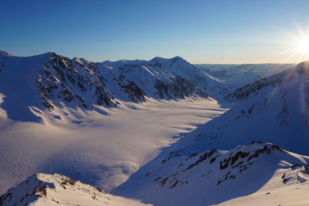
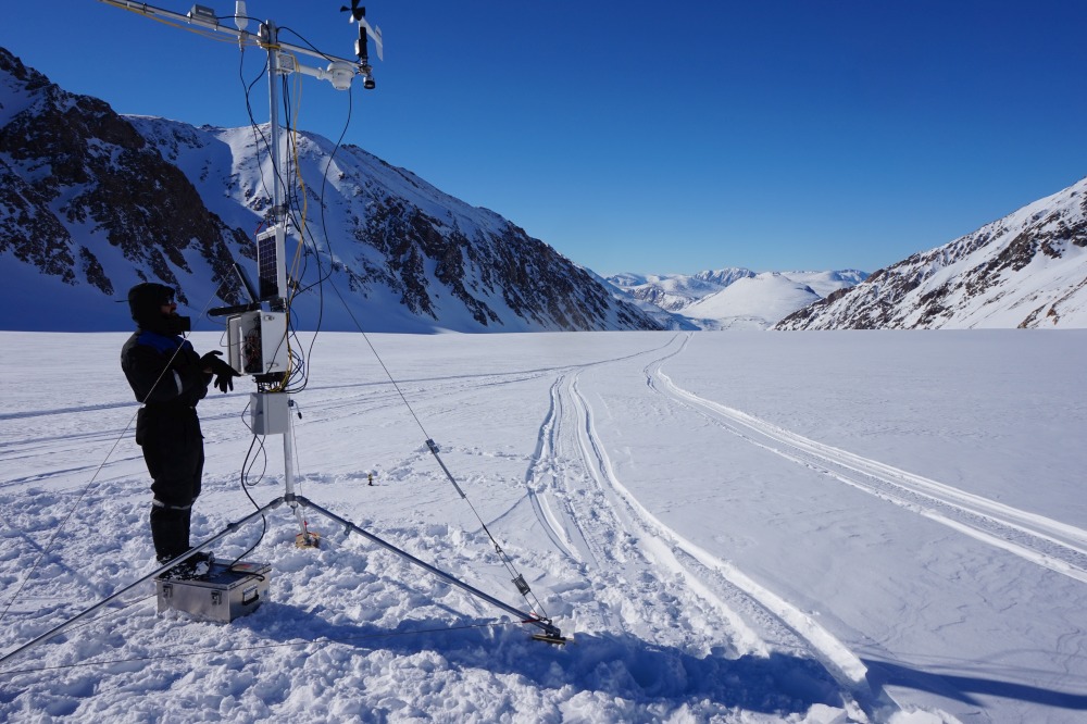
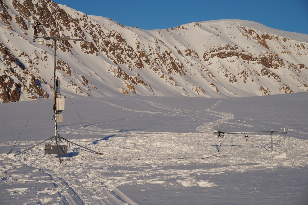
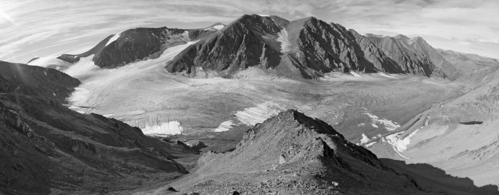
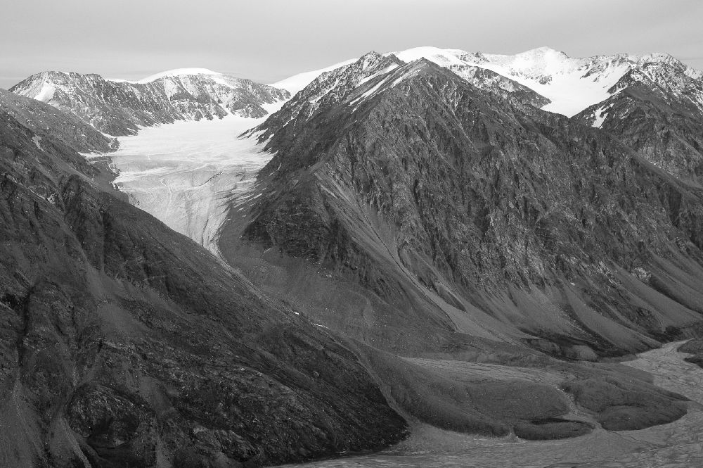
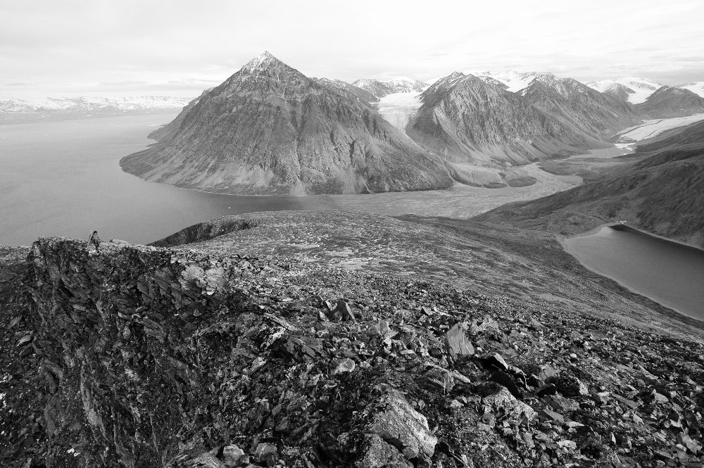
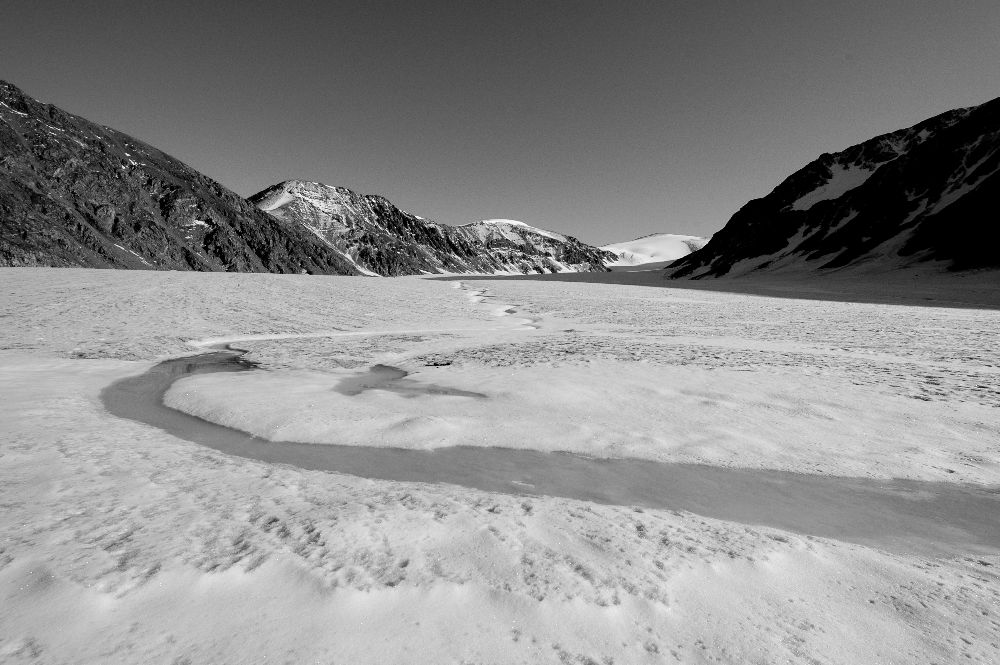
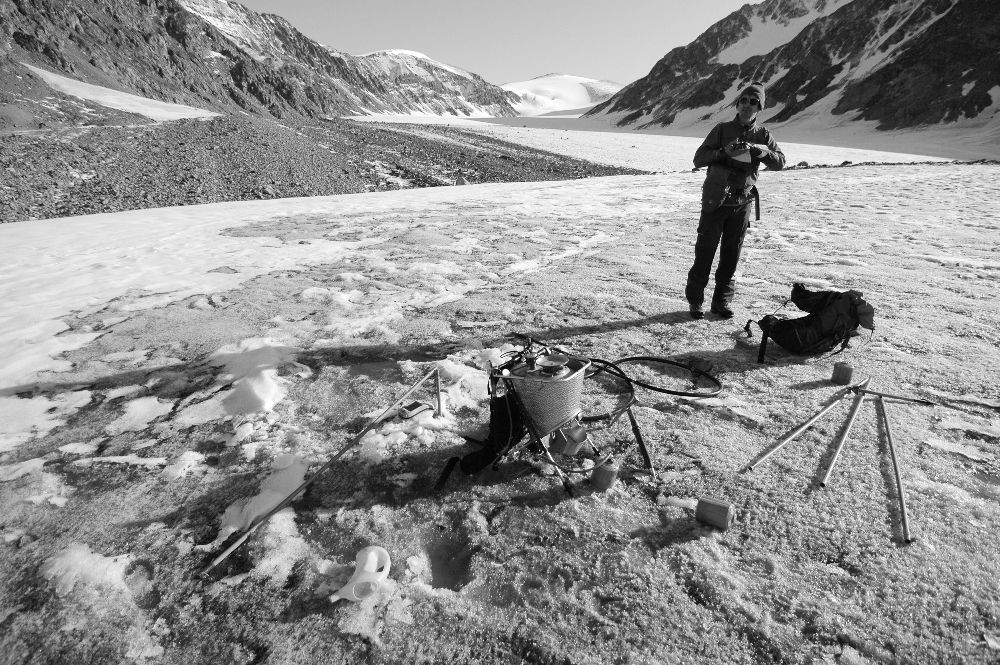
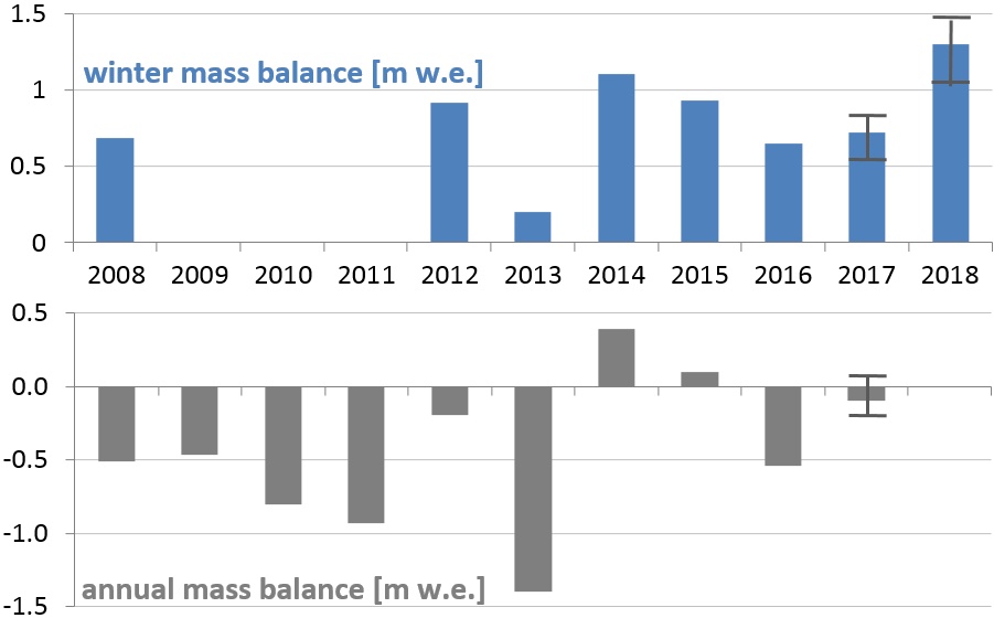
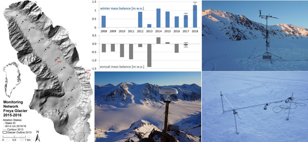
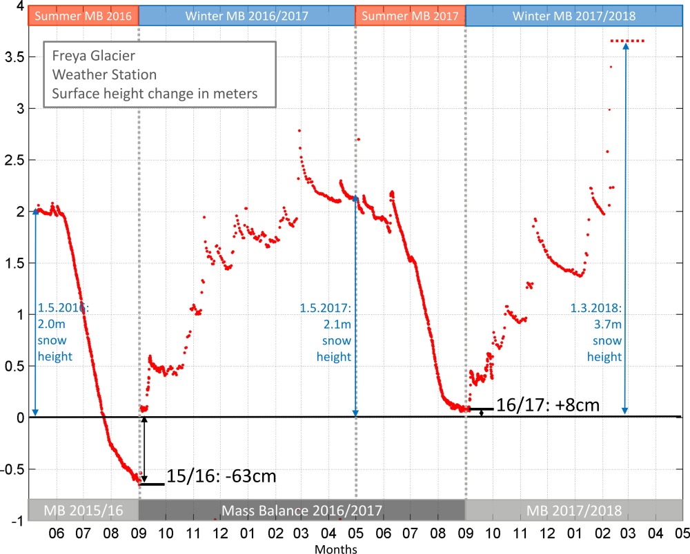
The snow cover on Freya Glacier is usually 2 Meters thick in late winter. Repeated heavy snowfall events in February 2018 accumulated a snowheight of least 3.7 meters and burried our weather station in snow.

This graph shows the current monitoring network on Freya Glacier, with the automatic camera and the weather station, and the time series of winter- and annual mass balances since the start of the measurements.
Snow height and snow/firn ablation at the weather station on Freya Glacier. During the winter 2015/16 and 2016/17 typical winter snow heights are slightly above 2 meters, but in winter 2017/18 the snowheight on the site was approx. 4 meters.

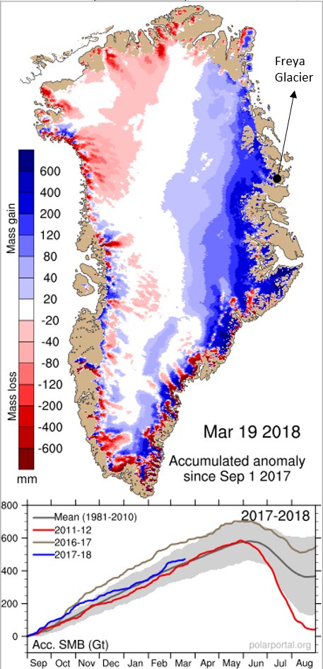
This map shows the distribution of the accumulation anomaly in winter 2017/18 over Greenland. Source: Polarportal.dk.

Freya Glacier lies on the northern East coast in an area of high positve accumulation anomalies. This will significantly influence the annual mass balance of Freya Glacier in 2017/18, which will most likely be positive.

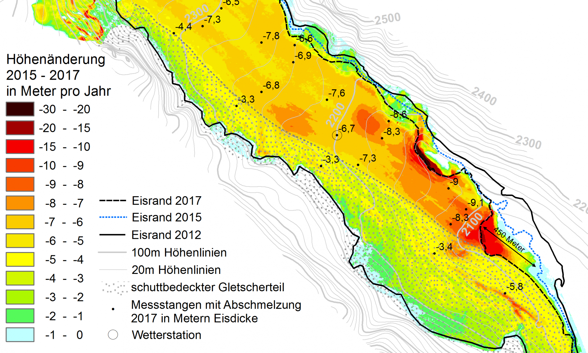
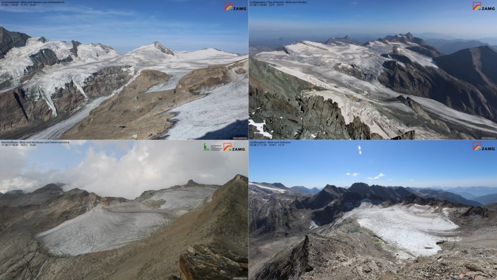
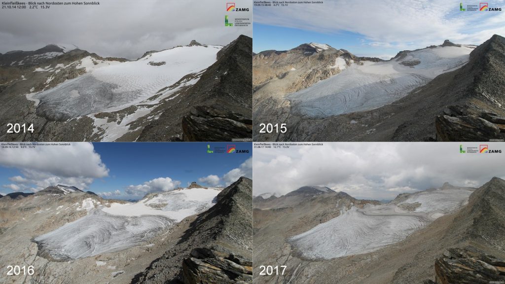
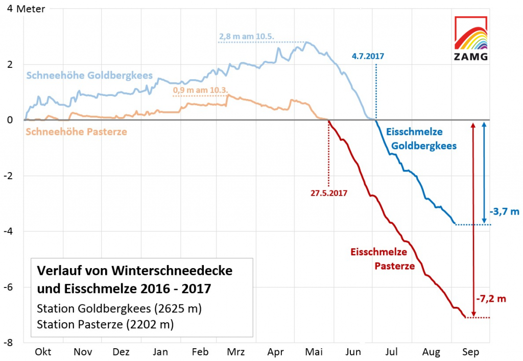
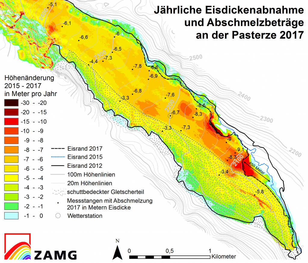
Here the Press Release in German and with more details the ZAMG Website.

Extreme glacier mass loss in 2017

The Glaciers in Hohe Tauern National Park experienced another year of extreme negative mass balance in the budget year 2016/2017.

The Austrian glaciers Pasterze (top), Kleinfleißkees (bottom left) and Goldbergkees (bottom right) at the end of August 2017, when the snow covered area on the glacier was at a minimum. Almost all the winter snow cover had been melted during the summer and the ice surface had been exposed to surface melt for a long time during June, July and August 2017.
A comparison of the end of summer snow cover of Kleinfleißkees during the last 4 years shows, that the snow covered area on the glacier in 2017 was the smallest within the last 4 years and that even the firn covered area of the glacier in 2017 is smaller than in 2015.
The automatic weather and mass balance station on Pasterze (left) measured more than 7 meters of ice thickness change, while the mass balance station on Goldbergkees (right) measured only 3.7 meters of ice ablation.
This diagram shows the development of the snow cover during the accumulation season and the ice melt in spring and summer. Due to less amount of winter snow, the ice surface at Pasterze was longer exposed to the atmospheric energy exchange than the ice at the station at Goldbergkees.
Annual ice thickness change at Pasterze glacier between 2015 and 2017 (coloured map) and ablation values at the stakes during 2017. The retreat of the rock free glacier snout within the last two years was more than 450 meters.

Field trip to Pasterze by TGM and ZAMG

After some attempts in previous years, again we agreed on a date and finally the weather was perfect for a joint field trip to Pasterze in October 2017. We – glaciologists from ZAMG + students and teachers from TGM made a joint field trip to Pasterze to make some experiments on WLAN data transmission in the real world and to get a feeling about the ongoing glacier retreat, and travelling safe and working on a glacier that big as Pasterze.

The path down to the glacier during nice weather in mid October 2017.
Passing the glacier front position from 2000.
in 5 minutes of walk we pass 5 years of glacier recession: The glacier front position from 2005.
Again some minutes later, we pass the front position of 2010. This was the front position only 7 years ago!
Hiking the canyon, that has formed on the orographic left side of the glacier snout.
Walking on the glacier snout on Pasterze.
Ice wall at the orographic left side of the glacier snout.
Close-up view of the ice debris at the base of the ice wall.
Icebergs in the proglacial lake of Pasterze.
We gaze at icebergs in Austria!
On our second day we even climbed up to visit the automatic camera on Freiwandeck.
The climb to the Automatic camera on Freiwandeck was steep and challenging!
And the view down to Großglockner Hochalpenstraße was nearly vertical at some points!
Nice colours and formations at the sediment deposits below the glacier.

New webcams and weather station on Freya Glacier!

Within the combined research and education project Glacio-Live we were aiming to install our automatic glacier measurement system far away north in the Arctic, on a small mountain glacier on the East Coast of Greenland, Freya Glacier.

Freya (Fröya) Glacier is a 6km long valley glacier situated on Clavering Island 10km southeast of the Zackenberg research station at the northeastern coast of Greenland. Its surface area is 5.3 km² (2013), reaching from 1300 m to 280 m a.s.l. and mainly oriented to NW with two seperated accumulation areas oriented to NE and NW.

We have been measuring the mass balance of the glacier since 2007, we already had two weather stations and two automatic cameras there, but without transmitting the data in near real time. So the aim for the expedition in spring 2016 was to install a new weather station with data transmission and two high quality webcams, that should cover almost the whole glacier surface and transmit an image per day.

Here you find the mass balance data here and the technical report of the fieldwork in spring 2016.

Crossing the fjord on our way from Zackenberg research station to Freya Glacier. We carry sledges with more than 300 kg of equipment.
The first challenge was the steep slope up to the terminal moraine of Freya Glacier. But snow conditions were good and allowed us to take the steep step onto the glacier!
My colleage Daniel Binder having a rest on Freya Glacier at an elevation of 700 m.
After one day of exploring we found a perfect rock to install our webcams. But good spots for cameras are at high places, so we had to park our ski doos and carry all the equipment of more than 300 kg (!) by ourselves up that slope to an elevation of 1053m a.s.l. …
Backpacks of more than 30 kgs…
We went up there 7 times. Climbing up there in the morning when the snow was very hard, I really missed my ski crampons that I had forgotten at home… 🙁
Some climbing involved at the upper part of the ascent.
A good storage area behind the camera rock.
Installing the solar panels and the pole for the Iridium Satellite Antenna.
Two cameras, three solar panels and four metal cases for the batteries, the solar charger and the Iridium modem.
And finally the Iridium Antenna.
10 meters above the cameras we mounted a wind mill to generate power during the Arctic winter.
The power cable from the wind mill to the camera station.
The installation from below.
Getting the system running, troubleshooting in -25°C.
The view from the position of the camera glacier upwards and downwards.
A few days later we installed the new weather station on Freya Glacier together with Michele Citterio from GEUS. Again, we were very lucky with the weather, we also drilled 11 new ablation stakes on that day.
In the late evening the work is finished. The new weather station on Freya Glacier is operating and sending data!

Freya Glacier – History

Freya (Fröya) Glacier is a 6km long valley glacier situated on Clavering Island 10km southeast of the Zackenberg research station at the northeastern coast of Greenland. Its surface area is 5.63 km² (2013), reaching from 1300 m to 280 m a.s.l. and mainly oriented to NW with two seperated accumulation areas oriented to NE and NW. The thickest ice found during a GPR survey in May 2008 is 200m, located at the confluence of the two accumulation areas. GPR-data suggest, that Freya Glacier is a polythermal glacier with temperate ice in a limited area only, at the ELA near the bottom of the glacier.

Mean values (1996-2005) of anual temperture and precipitation at Zackenberg (38m a.s.l.) are -9.2°C and 230mm. Mass balance measurements at Freya Glacier have been carried out by ZAMG since 2007/08, the mean annual mass balance 2008-2018 is -0.3m w.e.

Within the project Glacio-Live, a new automatic weather station (AWS) and two automatic cameras were installed on Freya Glacier in spring 2016.

Panorama photo of Freya Glacier in August 2013 (photo: B. Hynek).
Freya Glacier and its distinct terminal moraine in August 2009 (photo: B. Hynek).
From left to right: Tyroler Fjord, Moltke Bjerg, Freya Glacier and Skille (Vintergata) Glacier in August 2009 seen from Eiger (photo: B. Hynek).
A superglacial stream on the surface of Freya Glacier in August 2009 (photo: B. Hynek).
Drilling ablation stakes into the ice of Freya Glacier in August 2009 (photo: B. Hynek).
Surface mass balance time series of Freya Glacier.

Annual surface mass balance data are available here.